SkyData UAV
  • Home
  • About Us
  • Our Services
    • Building Facade Surveys
      • What Is a Milestone Inspection
      • Why Concrete Fails
    • Construction Progress
      • What Are Pre-Construction Videos
    • Road & Parking Lot PCI Results
    • Confined Space Inspections
    • Roof Surveys
    • Photographs and Point Clouds
    • Governments Projects
  • Projects
    • Broward County Water and Sewer Project
    • Condominium Vertical Survey
    • Port Everglades Parking Garage Construction
    • Hialeah Charter School
  • Our Team
  • Contacts
Contact Us
SkyData-UAV-Logo.
SkyData-UAV-Logo.
  • Home
  • About Us
  • Our Services
    • Building Facade Surveys
      • What Is a Milestone Inspection
      • Why Concrete Fails
    • Construction Progress
      • What Are Pre-Construction Videos
    • Road & Parking Lot PCI Results
    • Confined Space Inspections
    • Roof Surveys
    • Photographs and Point Clouds
    • Governments Projects
  • Projects
    • Broward County Water and Sewer Project
    • Condominium Vertical Survey
    • Port Everglades Parking Garage Construction
    • Hialeah Charter School
  • Our Team
  • Contacts

Building Facade Surveys

What We Offer

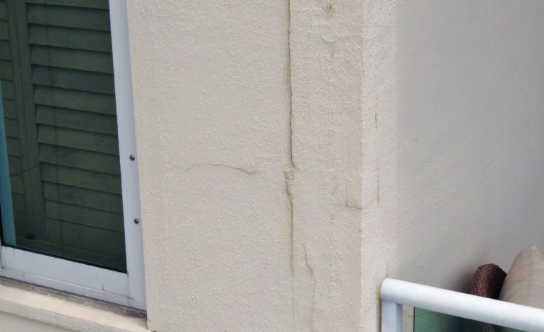
Condominium Façade Surveys For Structural Engineers Condominium and Commercial Building Façade Surveys SkyData UAV delivers detailed images from vertical drone surveys of high-rise buildings…

Learn more

Roof Surveys

What We Offer

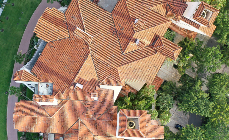
Roof Surveys: Condominiums and Single-Family Homes Roof Surveys Single-family Homes • Condominiums Apartments • Retail Buildings Office Buildings • Warehouses Roofing companies, public insurance adjusters…

Learn more

Construction Progress Photography and Video

What We Offer

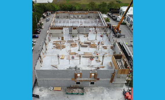
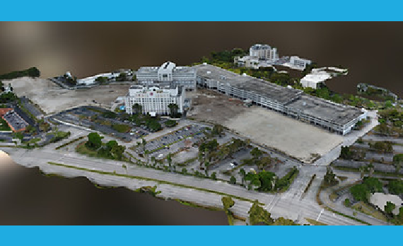
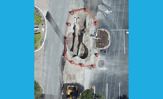
Construction Progress Photography and Video Verify Construction Progress With SkyData UAV SkyData UAV documents existing conditions prior to construction, construction progress…

Learn more

Pavement Management: Parking Lots, Residential Road and Highways

What We Offer

Your pavement assets are worth millions. Protect them with precise data, aerial technology, and expert project execution. Our independent PCI-based platform empowers you to confidently validate pricing, plan budgets, and scope work.

Gain control with:
PCI scoring tied to real-world conditions
Auto-generated, standardized RFPs
Up to 30% cost savings
Predictive five-year maintenance planning

Learn more

Confined Space Inspections: Buildings and Power Plants

What We Offer

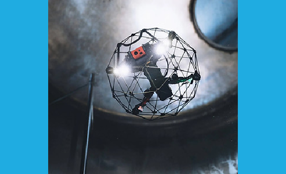
Confined Space Inspections: Buildings and Power Plants Confined Spaces Surveys SkyData UAV safely provides engineering firms, power companies, industrial operations, construction companies…

Learn more

Photographs and Point Clouds For Engineering Design

What We Offer

Photographs and Point Clouds For Engineering Design SkyData UAV Provides Images and Data for Engineers and Architects to More Accurately Plan Projects Aerial imaging by SkyData UAV helps engineers…

Learn more

Governments Projects

What We Offer

Governments Projects SkyData UAV Helps Contractors Verify Construction Progress for Government Projects SkyData UAV documents existing conditions prior to construction, construction progress…

Learn more

LET'S FLY...

Ready to ensure the safety and integrity of a high-rise building or more detailed information about a construction site?
Contact us today to schedule your consultation!

Contact Us

SkyData UAV – Delivering precision and safety to high-rise building inspections and construction sites with state-of-the-art drone technology.

Services

  • Façade Surveys
  • Construction Progress
  • Parking Lot and Road PCIs
  • Confined Spaces
  • Roof Surveys
  • Goverments Projects

Contact Info

  • 4001 SW 108 Terrace Davie, FL 33328
  • 954.647.3924
  • [email protected]
© SkyData UAV 2024
  • Linkedin