Building Façade Surveys

Façade Surveys of High - Rise Buildings for Milestone Inspections
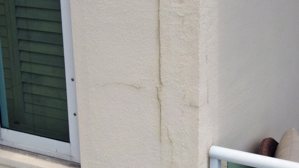
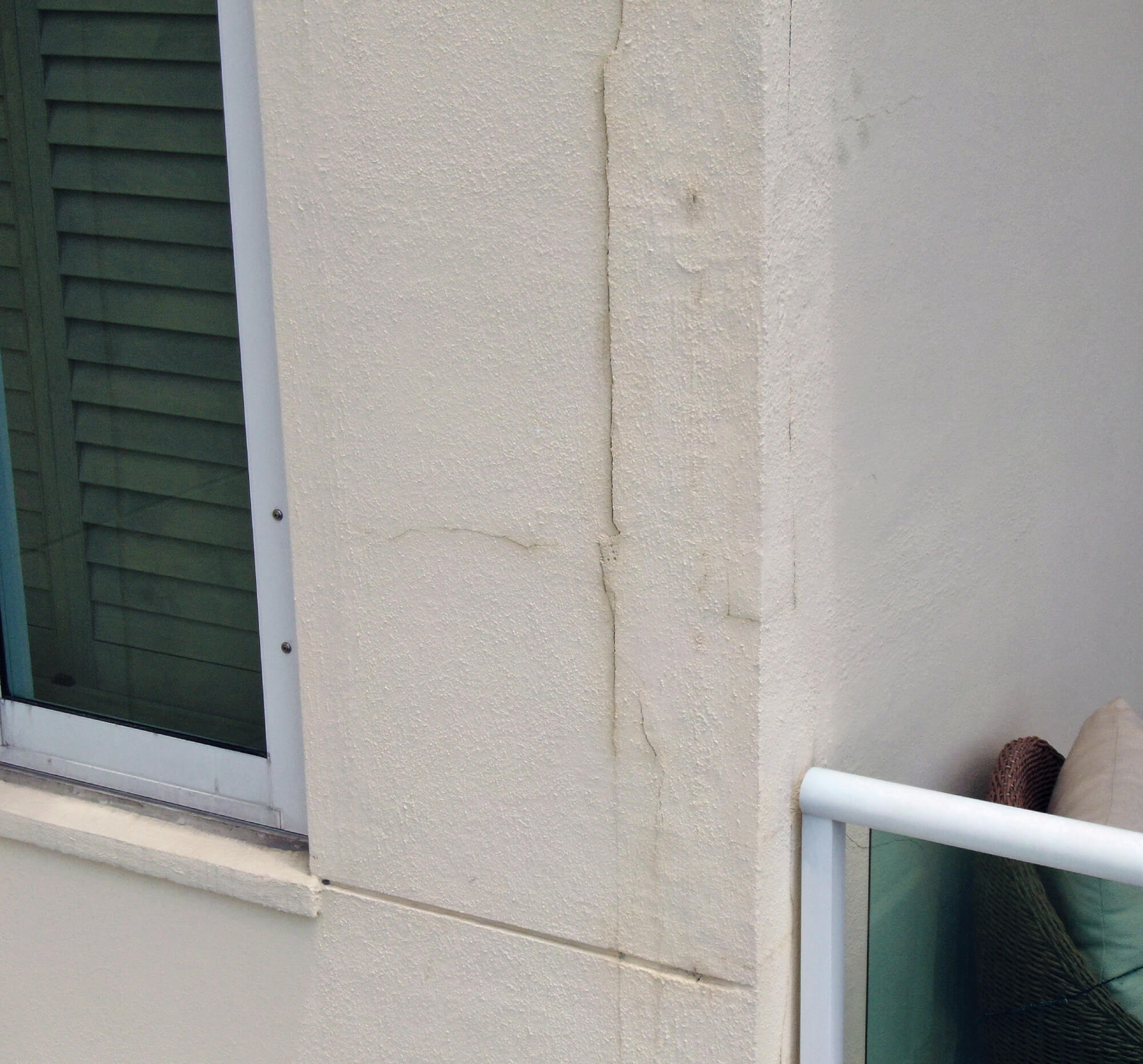
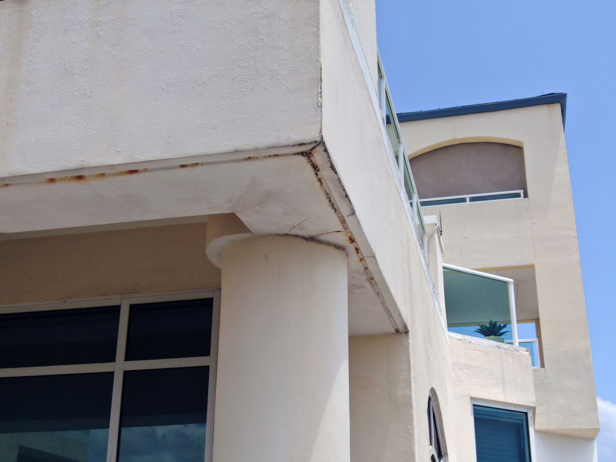
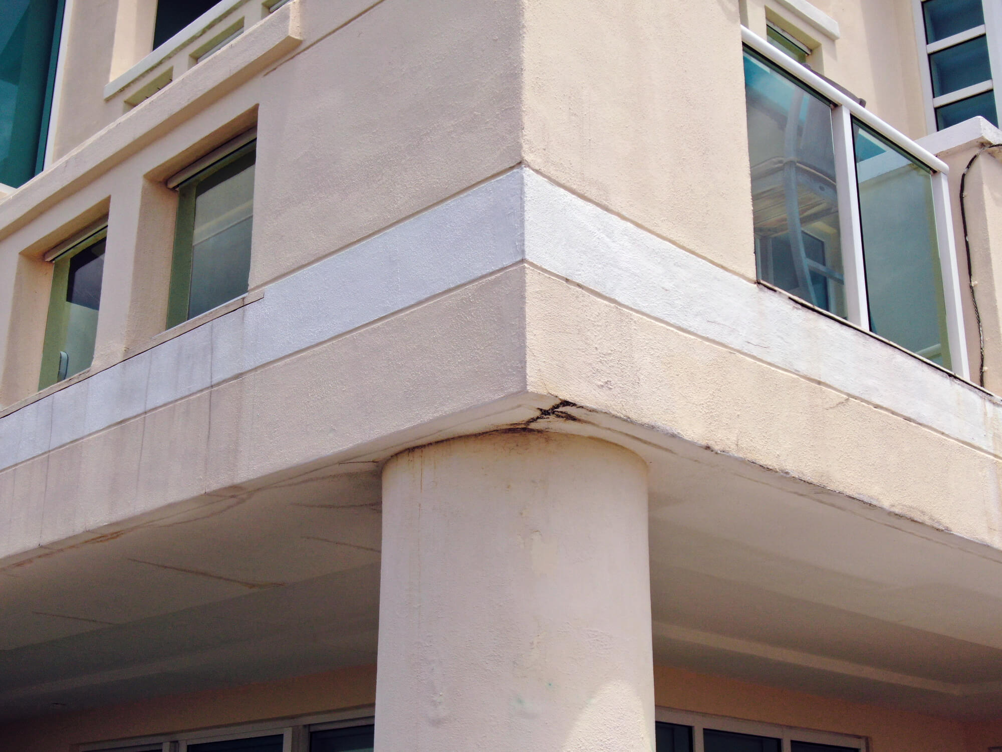
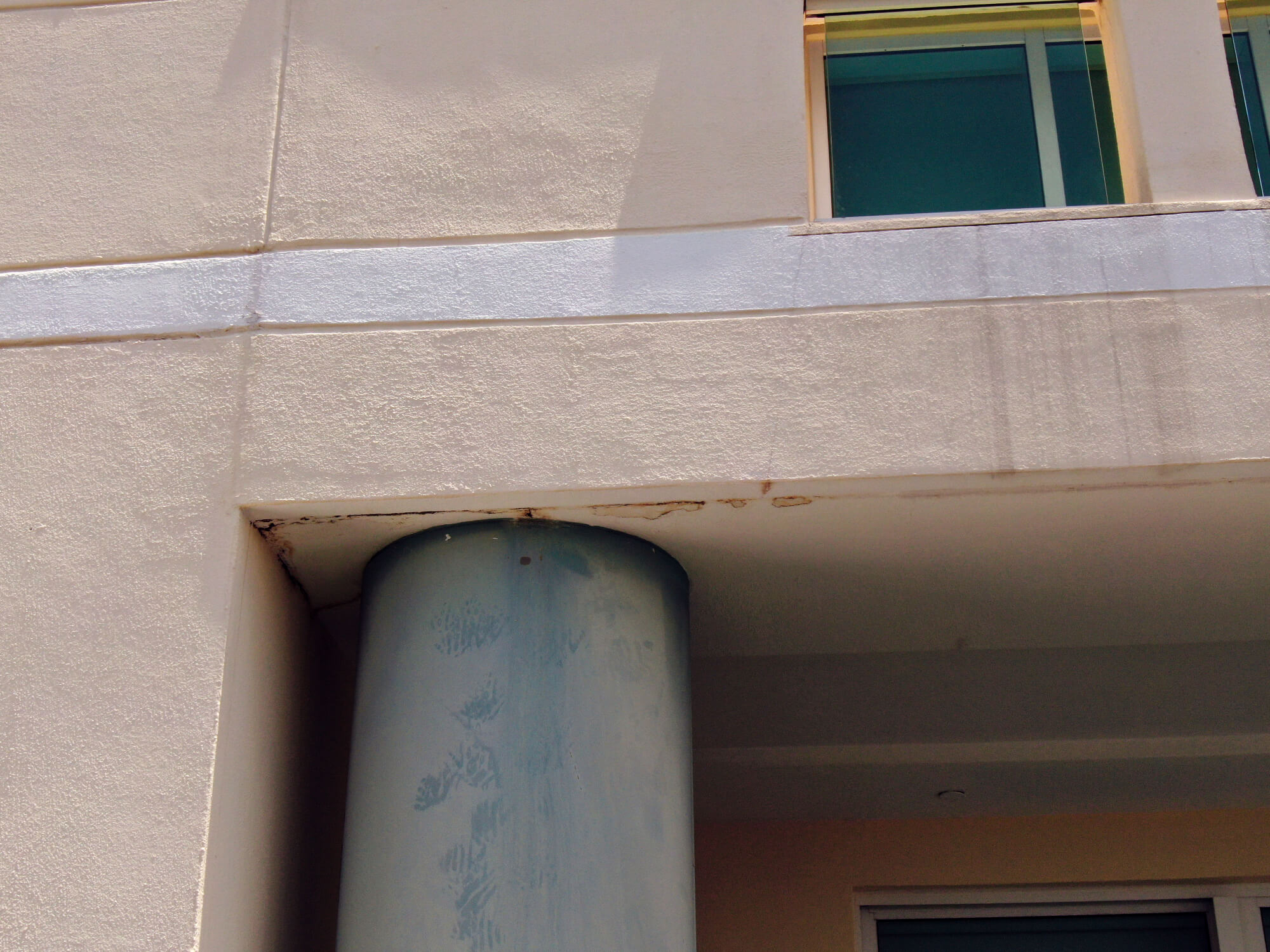
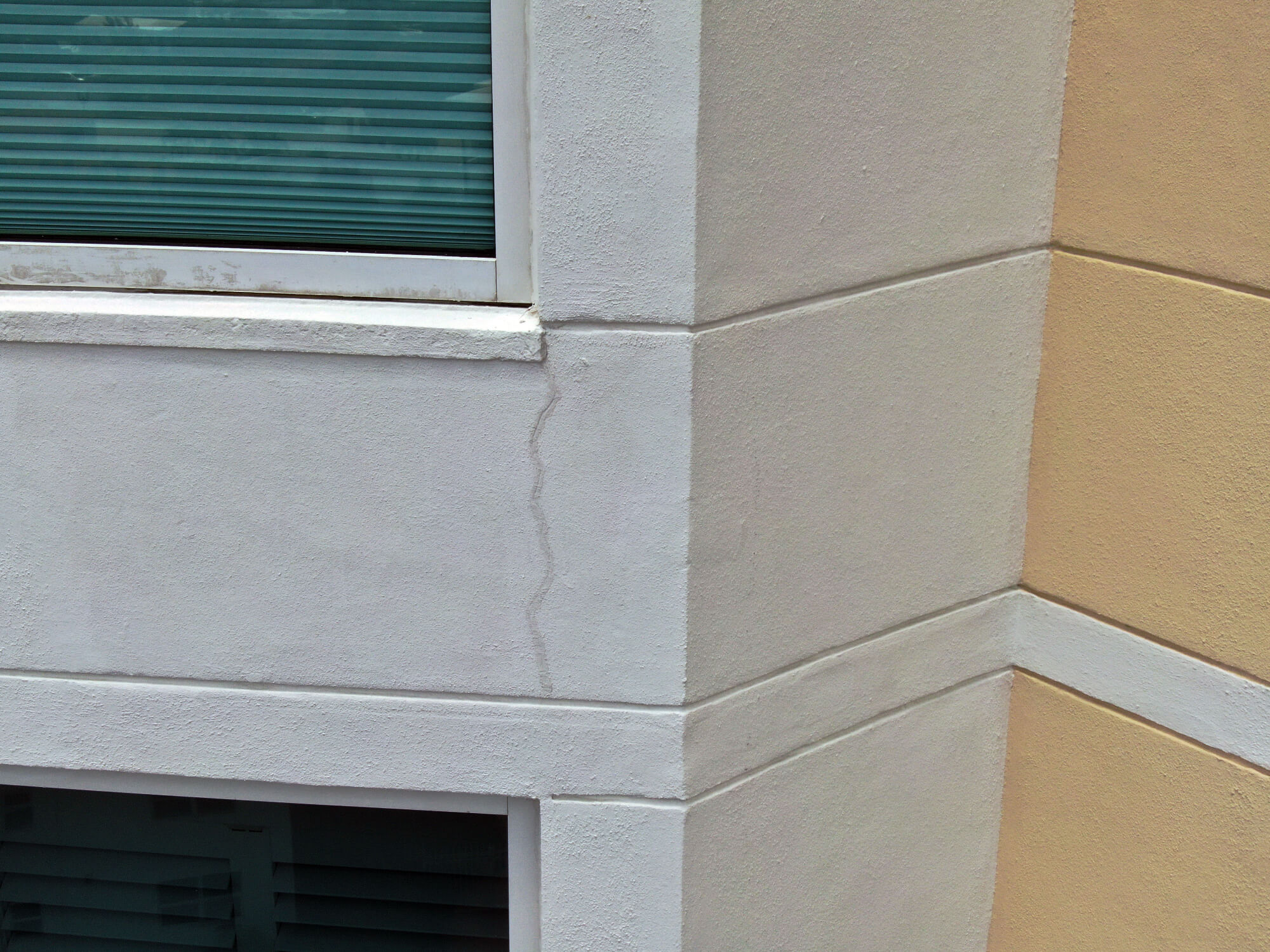
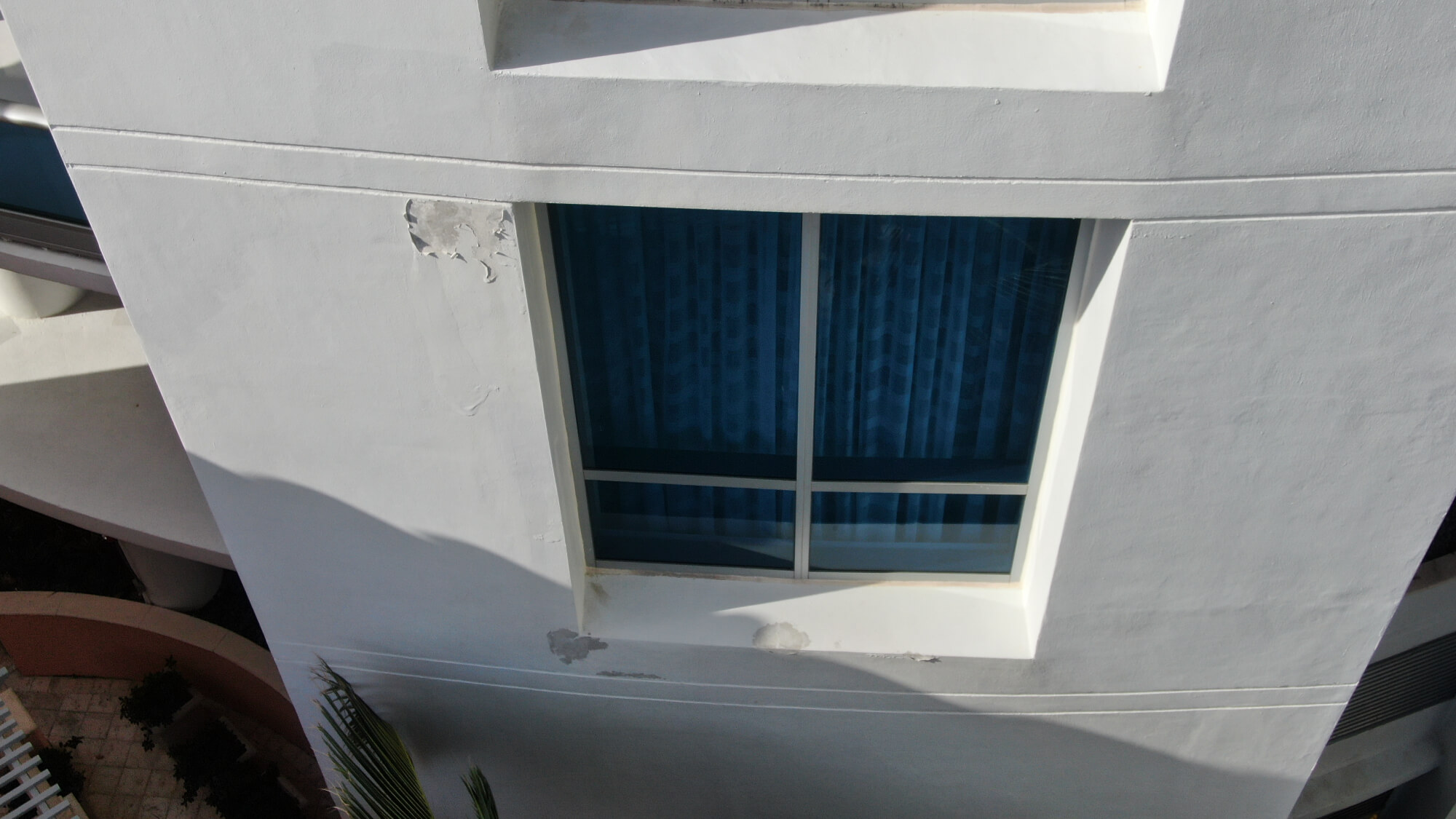
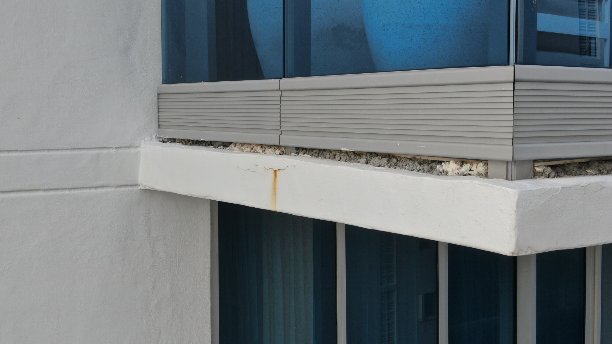
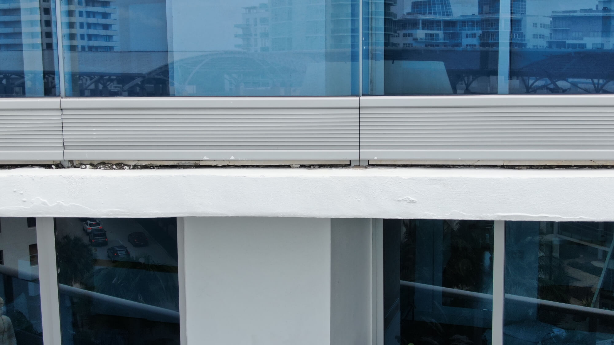
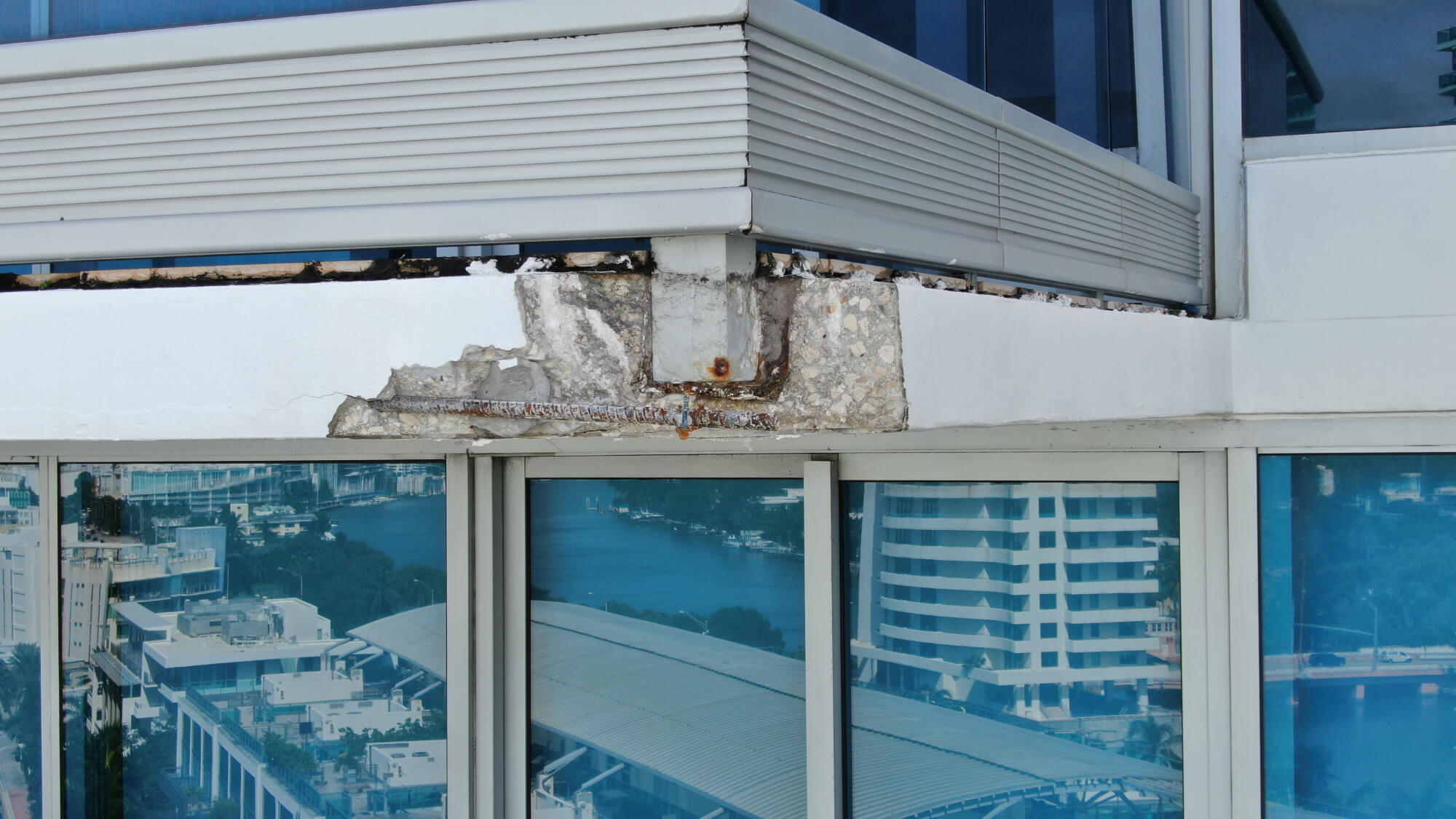
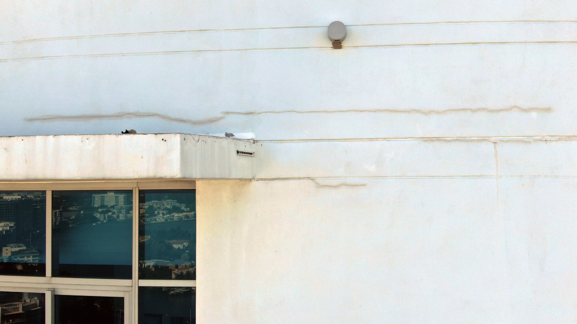
Spalling, broken concrete, cracks and other imperfections and potentially dangerous flaws on high-rise building façades, balconies and parapets are found with detailed drone surveys. SkyData UAV’s condominium and commercial building façade survey services provide a detailed view of these and other deficiencies from the top down ofsome of the tallest buildings in Florida. SkyData’s systematic process for collecting and organizing images enablesstructural engineering firms and condominium associationsto precisely pinpoint building envelope problems for milestone inspections.
Since the tragic collapse of Chamberlain Towers South in Sunny Isles, FL, Florida, on June 24, 2021, the State of Florida passed laws that now require buildings three or more stories in height, 25 years old within three miles of the coast, and 30 years old more than three miles from the coast to havemilestone inspections. Afterwards, milestone inspections must be completed every 10 years.
WHEN TO USE DRONES FOR FAÇADE SURVEYS
SkyData UAV façade surveys are conducted:
- For government-required 25- and 30-year milestone and interim inspections.
- Before and after construction of adjacent buildings.
- Before and after structural repairs and painting.
- Pre- and post-hurricanes.
- To document construction progress.
What is a milestone inspection? (link)
By supplementing milestone inspections with drones, structural engineers, condominium associations, attorneys and contractors can identify existing and potential concrete structural and façade problems caused by weather, salt-water corrosion and poor construction methods. Drones safely and cost-effectively reach heights and hard to access areas of buildings more quickly, efficiently and cost-effectively than inspectors on swing stages, leaning over balconies or observing from the ground.
WHY DRONES ARE USED IN MILESTONE INSPECTIONS
With SkyData UAV, we helpstructural engineering firms accelerate their workflow by saving time on milestone inspections.
- Faster survey:
- - Drone: One to two days.
- - Manually from a swing stage: Five-plus days.
- More cost effective: Several thousand dollars versus tens of thousands of dollars by using a swing stage.
- Safer than manual inspections.
- Collect images of hard-to-see and -reach places.
- Pinpoints problems for manual inspections.
DRONES SYSTEMATICALLY CAPTURE IMAGES
SkyData UAV flies with technologically advanced drones with high-resolution cameras in a series of over-lapping vertical patterns to provide outstanding detailed images of buildings surfaces, balconies, windows and roofs.The UAV is flown 20 to 25 feet from a building’s façade and circumnavigates the building, capturing overlapping photographs and video.
We provide high-resolution photographs and videos that document deficiencies at all elevations, including:
- Cracks
- Balcony failures
- Broken concrete
- Exposed rebar
- Missing stucco
- Paint failure
- Post-tension cable post pockets
- Railing post pockets
- Roofs: Cracked tile and slippage
- Spalling
- Window caulking
Photographs and video are organized and presented in a manner that is easily reviewed, managed and added to building reports.