Photographs and Point Clouds For Engineering Design
SkyData UAV Provides Images and Data for Engineers and Architects to More Accurately Plan Projects
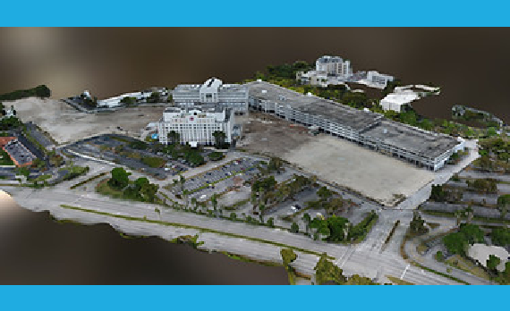
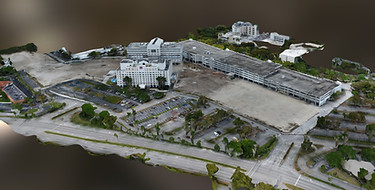
Aerial imaging by SkyData UAV helps engineers and architects to more accurately visualize their projects. SkyData captures images and data at lower altitudes and from multiple angles, in significantly higher detail and at a lower cost per image than from manned aircraft.
Aerial imaging by SkyData UAV helps engineers and architects to more accurately visualize their projects. SkyData captures images and data at lower altitudes and from multiple angles, in significantly higher detail and at a lower cost per image than from manned aircraft.
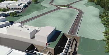
Our services provide designers and architects with an idea of how a new structure or landscape design will fit aesthetically and practically in an open space and in the context of the surrounding area.
ENGINEERING-QUALITY IMAGES AND DATA
SkyData UAV’s engineering support solutions enable clients to digitize projects and job sites through aerial photography, video, aerial 2D and 3D mapping, orthographic projection and photogrammetry. File format deliverables include:
- FBX
- LAS
- OBJ
- Ortho
- RCM
- RCS
- SHP